
We're proud to offer a simple, accurate and up-to-date GIS database for the 120th United States Congress. We've built it from the ground up by aggregating state-level data as approved by state legislatures due to redistricting after the 2020 Census.
Databases | Basic | Comprehensive |
|---|---|---|
| Commercial use | Allowed | Allowed |
| Projection | WGS84, Albers USA | WGS84, Albers USA |
| File format | Shapefile, SVG | Shapefile, GeoJSON, SVG |
| Resolution | Low Resolution | High Resolution |
| Attribution | Required | Not Required |
| License | Creative Commons Attribution 4.0 | Permissive, no redistribution |
| Future updates | Not guaranteed | Included for 12 months |
| Refund policy | N/A | 30-day guarantee |
| One-time fee | Free | $499 |
| Buy Now! |
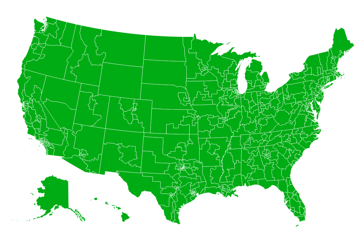
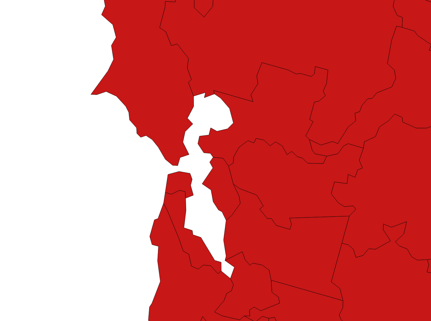
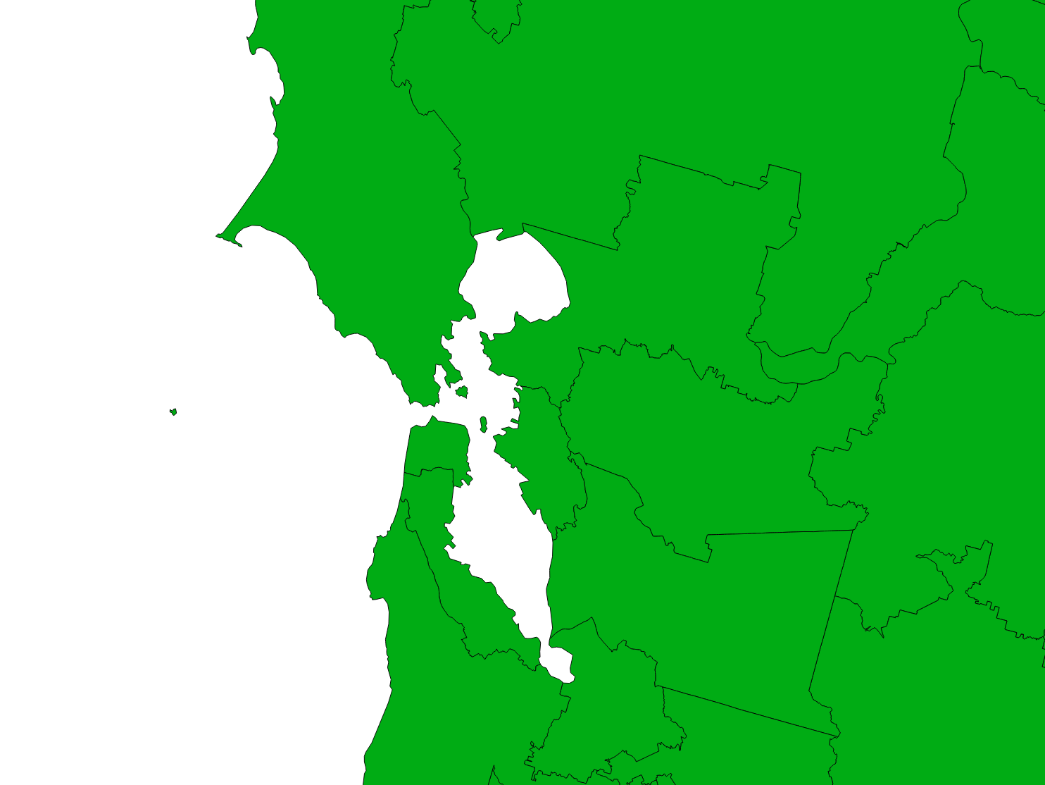
Here are a few screenshots that visualize the GIS shapes.
All districts
Low-resolution free version
High-resolution paid version
| fieldname | description | Basic | Comprehensive |
|---|---|---|---|
id |
The id for each congressional district (e.g. AL01). | ||
fips |
The fips code for each congressional district (e.g. 0101). | ||
name |
The name of each congressional district (e.g. District 01). | ||
geometry |
Not technically a field, but the shape of each district will be represented as a Polygon/Multipolygon in a format consistent with GIS file format. | ||
congress |
The meeting/number of the congress (e.g. 119). It will be the same for all districts. |
Is this the Congress that will be elected in November of 2026 and serve starting in January of 2027?
Yes. This is border data for the 120th Congress.
What changes were made between the 119th and 120th Congress?
We've updated congressional districts in California, Texas, Alabama, Florida, Louisiana, North Carolina, Ohio, Tennessee, and Utah to reflect changes mandated by the states and upheld by the courts. The total district count remains 435.
Why doesn't the map reflect changes to a specific state?
Redistricting in a handful of states is still subject to ongoing litigation, so it remains unclear whether revised maps will be implemented before the next election. If you would like to see tentative changes to a state included that are not present, please contact us.
Can I get the border data for the 117th Congress (ending January 3, 2023), the 118th Congress (ending January 3, 2025), or the 119th Congress (ending January 2027)?
Yes, we can provide this shape data for no additional charge upon purchase, just email us.
Do you offer this product as a customizable interactive map?
Yes, please see our HTML5 Congress Map.
Am I allowed to redistribute the database if I purchase a paid license?
No. You are not allowed to sell the database or make it publicly available. However, you can make copies and backups of the data. You are also allowed to query the database to power publicly facing applications. To learn more, read the full license terms.
Why should I trust this data?
This database was aggregated from authoritative sources and carefully processed by SimpleMaps. We've been developing and selling interactive maps to Fortune 500 companies and prominent international organizations for over 16 years. Over this time, we've learned a lot about geographic data. To get a sense of the expertise and support we offer, check out some of the testimonials from our happy customers.
If I use the free database, what type of attribution is required?
If you use the Basic (free) database, you must link back to this page:
https://simplemaps.com/data/congress
from a public webpage where you are using the data. If you want to use the data internally, you must link back to this page from your firm's website on a page that can be easily found though links on the root domain. The link must be clearly visible to the human eye.
Home (Maps) | Database License | Privacy | Database Releases | Database Order Lookup | Resources | Contact | FAQs
Popular Resources: Free SVG Maps | Free GIS Files | Free Cities Data | Zip Code Visualizations | Trauma Centers by State | Geography Quizzes
SimpleMaps.com is a product of Pareto Software, LLC. © 2010-2026.