October 10, 2010
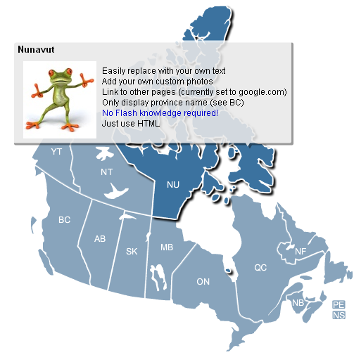
One of the common requests we’ve received at FlashUSAmap.com is for a map of Canada. I’m happy to announce that we’ve just released just such a map. The Interactive Flash Canada Map includes all 13 provinces. It is built with the same code used on our flash us map. This means it has all the features and reliability of our flagship product. Below is a screenshot of our new map:

You may have noticed that we have changed the look and feel of the map. We’ve changed the labels to white to make the map softer. Also, based on feedback from customers, we’ve decided to increase the opacity of the tooltip (the background is not as transparent anymore). This should make it easier to read text that you’ve included in the <description>. These design changes will be reflected in the newest update of our USA map as well.
The other main difference with the Canada map is the dimensions of the country. The United States is shaped like a wide rectangle while Canada is shaped more like a square. By default, the map is 500px X 500px, which makes resizing nice and convenient.
If you’re in need of an clickable map of Canada for your website, download the free trial.
Home | License | Privacy | Releases | Testimonials | Resources | Documentation | Order Lookup | All Maps | FAQs
Formerly FlashUSAmap.com and FlashWorldMap.com
SimpleMaps.com is a product of Pareto Software, LLC. © 2010-2025.