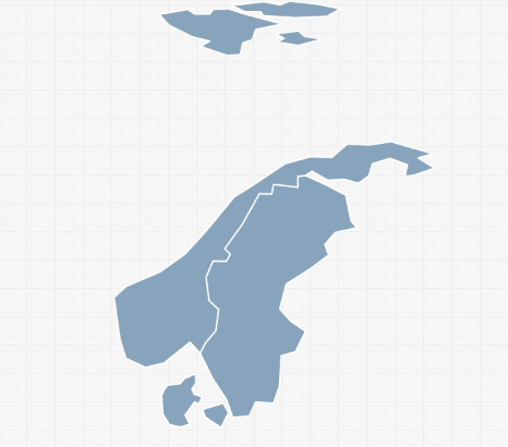
This is a short tutorial to show you how to create an interactive map of any group of countries in the world. We've used this approach to create maps for Europe, South America, Africa, South Asia and the Middle East. However, you may want to create a different region or tweak one of the above regions. In this example, we'll create a map of Scandinavia. Here is what you need to do:
Click on "Regions Tab"
Delete all the data in the spreadsheet (Click on "North America" --> CTRL-A --> Delete)
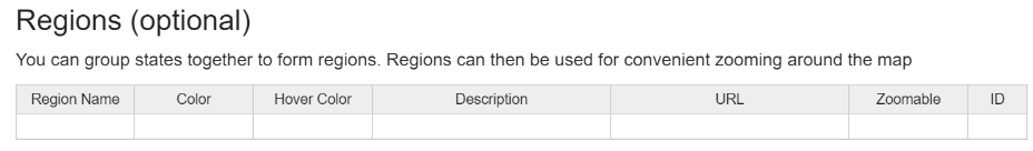
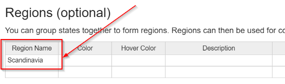
Create a new region, by typing a region name (e.g. Scandinavia) in the first row
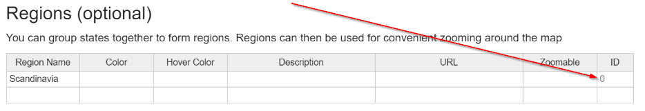
Note the id that is assigned to the region you create.
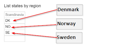
A new spreadsheet will be created below the first spreadsheet with a column for your region. Fill out this column with the ids of the countries you want in your region. Country ids can be found in the "States" tab or you can simply use a country's two-digit ISO code.
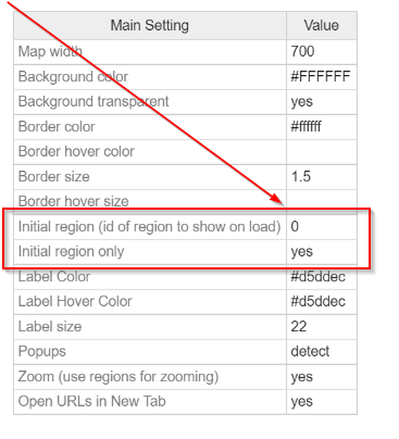
Click on the "Settings" tab
Change "Initial region" to the region id you remembered earlier ("0" if you have only one region) and change "Initial region only" to "yes"
You're done! You've created a map of a custom region in the world!
Here is a short video tutorial to illustrate this process:
Home | License | Privacy | Releases | Testimonials | Resources | Documentation | Order Lookup | All Maps | FAQs
Popular Resources: Free SVG Maps | Free GIS Files | Free Cities Data | Zip Code Visualizations | Trauma Centers by State | Geography Quizzes
SimpleMaps.com is a product of Pareto Software, LLC. © 2010-2026.